
Work has started on a new geological map of Ascension Island by staff at the British Geological Survey and Durham University. Mapping is being achieved using satellite imagery and ground-truthing fieldwork. It requires the scientists to pore over every rock on the island and is providing many new insights into Ascension Island’s volcanic past. So far fieldwork has focused on Upper Valley Crater, Northeast Bay, Cricket Valley, Weatherpost, and Devil’s Inkpot. Work will continue next year around the south and west sides of Green Mountain. The map will be published digitally by the British Geological Survey.
Why do we need a geological map?
Geological maps provide information on the distribution of volcanic deposits, such as lavas, layers of ash and pumice, and on the location of the vents and craters for individual eruptions. This can help when considering the nature and location of future eruptions on the island. Geological maps also act as starting points for geological research and scientific studies by providing researchers with accurate spatial information on volcanic rocks. Geological maps are dynamic sources of information and as new research happens they can be updated and modified.
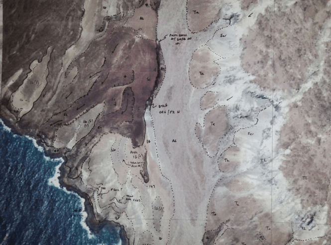
Printout of satelite photo used in the field for geological mapping.
